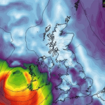
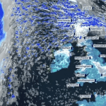
Heavy rain is expected to cause travel disruption over most of the UK, with some areas facing a “danger to life” from floods.
The Met Office has issued an amber warning for rain in north Wales and northwest England, including Manchester and Liverpool, beginning at midday on Wednesday for 24 hours.
According to the forecaster, fast-flowing or deep flooding is “likely,” and there is a significant probability that some localities may be cut off, experience power outages, and have train and bus services cancelled.
Meanwhile, a yellow rain warning is in effect for northern England, the Midlands, and northern Wales until 6 a.m. on Thursday, with showers also likely in the southeast between Norwich and Bath.
Another yellow rain warning will be issued for Scotland at noon on Wednesday, encompassing the south and east of the country, and will last until 6 p.m.
Thursday. The Met Office subsequently issued a third yellow warning for thunderstorms for much of England’s south coast on Wednesday from 8 a.m. to 7 p.m.
According to Met Office meteorologist Alex Burkill, “some areas will see a lot of heavy, persistent rain through a large portion of Wednesday.” For many regions, the rest of the week will be very wet.
The weather forecast says heavy and prolonged rainfall is expected from an area of low pressure arriving from the east, which has brought downpours to parts of central Europe overnight.
Many places across the UK could see 30-40mm of rain, while a few areas may receive 70-90mm as heavy rain moves northwards in England throughout Wednesday.
The Met Office said there is a small chance a few upland areas could see up to 50mm in the mountain in north Wales.
Northern areas of the UK are expected to remain cloudy and wet on Thursday but drier further south with brighter conditions becoming more widespread by the end of the week and temperatures hitting highs of up to 21°C.
Bank holiday Monday is expected to be dry for much of the country, although there remains the threat of showers after the more settled conditions


